uvsim::GeoCoord Class Reference
#include <GeoCoord.h>
Public Member Functions | |
| GeoCoord () | |
| Default Constructor. | |
| GeoCoord (double latitude, double longitude, double altitude) | |
| Constructor. | |
| ~GeoCoord () | |
| Destructor. | |
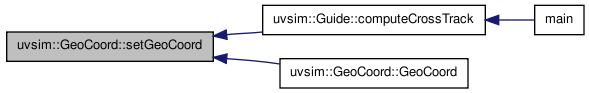
| void | setGeoCoord (double latitude, double longitude, double altitude) |
| Sets up the value for m_Latitude, m_Longitude, and m_Altitude. | |
| void | print () |
| Prints the output to the screen. | |
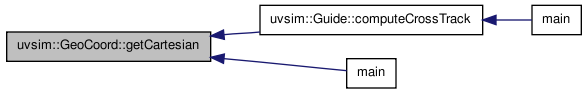
| vector< double > | getCartesian () |
| Converts from Geodetic coordinate to Earth Center Earth Fixed (ECEF) coordinate. | |
| void | getGeoCoord (double cartesianX, double cartesianY, double cartesianZ) |
| Converts from Earth Ceter Earth Fixed (ECEF) coordinate to Geodetic coordinate. | |
Public Attributes | |
| long double | m_Latitude |
| Stores the latitude of a position. | |
| long double | m_Longitude |
| Stores the longitude of a position. | |
| long double | m_Altitude |
| Stores the altitude of a position. | |
Friends | |
| std::ostream & | operator<< (std::ostream &out, GeoCoord &geoCoord) |
| Prints the resulting outputs to the screen as an output stream. | |
Detailed Description
GeoCoord Class.
This class does the conversion from Cartesian to Geodetic and vise versa.
This class also sets up the value for latitude, longitude, and altitude.
Definition at line 34 of file GeoCoord.h.
Constructor & Destructor Documentation
| uvsim::GeoCoord::GeoCoord | ( | ) |
Default Constructor.
Definition at line 30 of file GeoCoord.cc.
| uvsim::GeoCoord::GeoCoord | ( | double | latitude, | |
| double | longitude, | |||
| double | altitude | |||
| ) |
Constructor.
Sets up the initial value for m_Latitude, m_Longitude, and m_Altitude.
- Parameters:
-
latitude : The latitude position of a location. longitude : The longitude position of a location. altitude : The altitude position of a location.
Definition at line 36 of file GeoCoord.cc.

| uvsim::GeoCoord::~GeoCoord | ( | ) |
Destructor.
Definition at line 33 of file GeoCoord.cc.
Member Function Documentation
| vector< double > uvsim::GeoCoord::getCartesian | ( | ) |
Converts from Geodetic coordinate to Earth Center Earth Fixed (ECEF) coordinate.
The Conversion codes is based on WGS 84 and is taken from Wikipedia.
- Returns:
- Vector of Cartesian Coordinate
Definition at line 64 of file GeoCoord.cc.
| void uvsim::GeoCoord::getGeoCoord | ( | double | cartesianX, | |
| double | cartesianY, | |||
| double | cartesianZ | |||
| ) |
Converts from Earth Ceter Earth Fixed (ECEF) coordinate to Geodetic coordinate.
The Conversion codes is based on WGS 84 and is taken from Wikipedia.
- Parameters:
-
cartesianX : The x-coordinate in ECEF. cartesianY : the y-coodinate in ECEF. cartesianZ : The z-coordinate in ECEF.
Definition at line 83 of file GeoCoord.cc.

| void uvsim::GeoCoord::print | ( | ) |
Prints the output to the screen.
Definition at line 57 of file GeoCoord.cc.
| void uvsim::GeoCoord::setGeoCoord | ( | double | latitude, | |
| double | longitude, | |||
| double | altitude | |||
| ) |
Sets up the value for m_Latitude, m_Longitude, and m_Altitude.
- Parameters:
-
latitude : The latitude position of a location. longitude : The longitude position of a location. altitude : The altitude position of a location.
Definition at line 42 of file GeoCoord.cc.
Friends And Related Function Documentation
| std::ostream& operator<< | ( | std::ostream & | out, | |
| GeoCoord & | geoCoord | |||
| ) | [friend] |
Prints the resulting outputs to the screen as an output stream.
- Parameters:
-
out : Reference to the output stream. geoCoord : Reference to object geoCoord from GeoCoord class.
Member Data Documentation
| long double uvsim::GeoCoord::m_Altitude |
Stores the altitude of a position.
Definition at line 95 of file GeoCoord.h.
| long double uvsim::GeoCoord::m_Latitude |
Stores the latitude of a position.
Definition at line 87 of file GeoCoord.h.
| long double uvsim::GeoCoord::m_Longitude |
Stores the longitude of a position.
Definition at line 91 of file GeoCoord.h.
The documentation for this class was generated from the following files:
- /home/jgoppert/Projects/uvsim/uvsim/src/uvsim/guidance/GeoCoord.h
- /home/jgoppert/Projects/uvsim/uvsim/src/uvsim/guidance/GeoCoord.cc